Hurricane Erick has exploded into a Category 4 monster with winds topping 145 mph, taking direct aim at Mexico’s southern Pacific coast. If you’re in its path, now is the time to act—not wait. Here’s everything you need to know to stay safe.

Category 4 Alert: Erick Is Now EXTREMELY Dangerous
| Takeaway | Details |
|---|---|
| Winds | Sustained at 145 mph, Category 4 strength |
| Rainfall | Up to 20 inches possible in mountainous zones |
| Evacuation Centers | 580+ shelters ready for 120,000+ residents |
Erick isn’t just another summer storm—it’s a wake-up call. Its strength, speed, and timing mark it as one of the most dangerous early-season hurricanes in recent memory. If you’re anywhere near its path, this is your signal. Heed the warnings. Move to safety. Storms don’t wait.
A Rapid Rise to Power
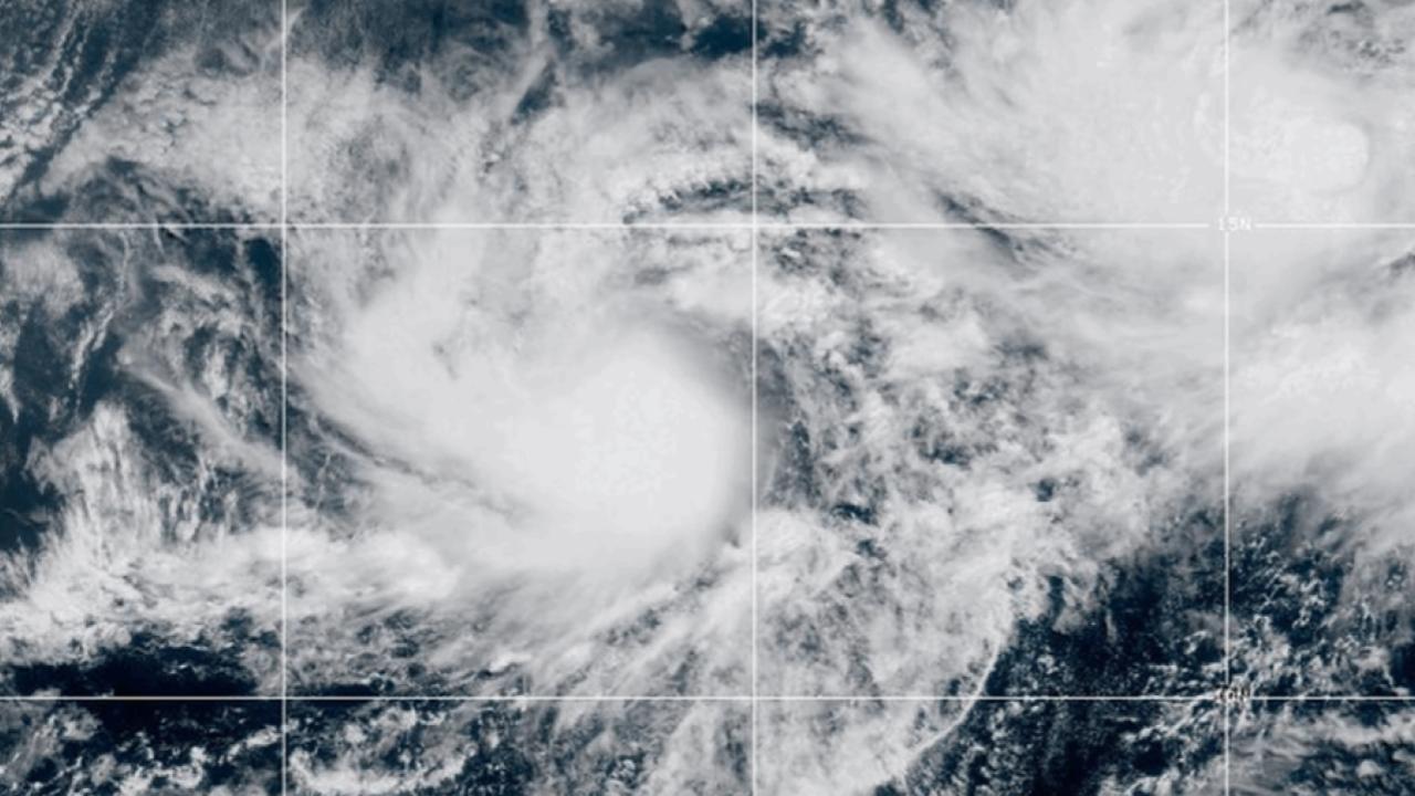
Erick was just a tropical storm 36 hours ago. Today? It’s a full-force Category 4 beast, one of the fastest-growing storms of the season. Meteorologists call this rapid intensification—and it’s as dangerous as it sounds. Warm ocean waters and high humidity acted like jet fuel, catapulting Erick into one of the strongest June storms Mexico has ever seen.
Having reported on hurricanes for over a decade, I’ve rarely seen such an abrupt and powerful shift. These quick escalations cut down preparation time—and that’s what makes Erick especially scary.
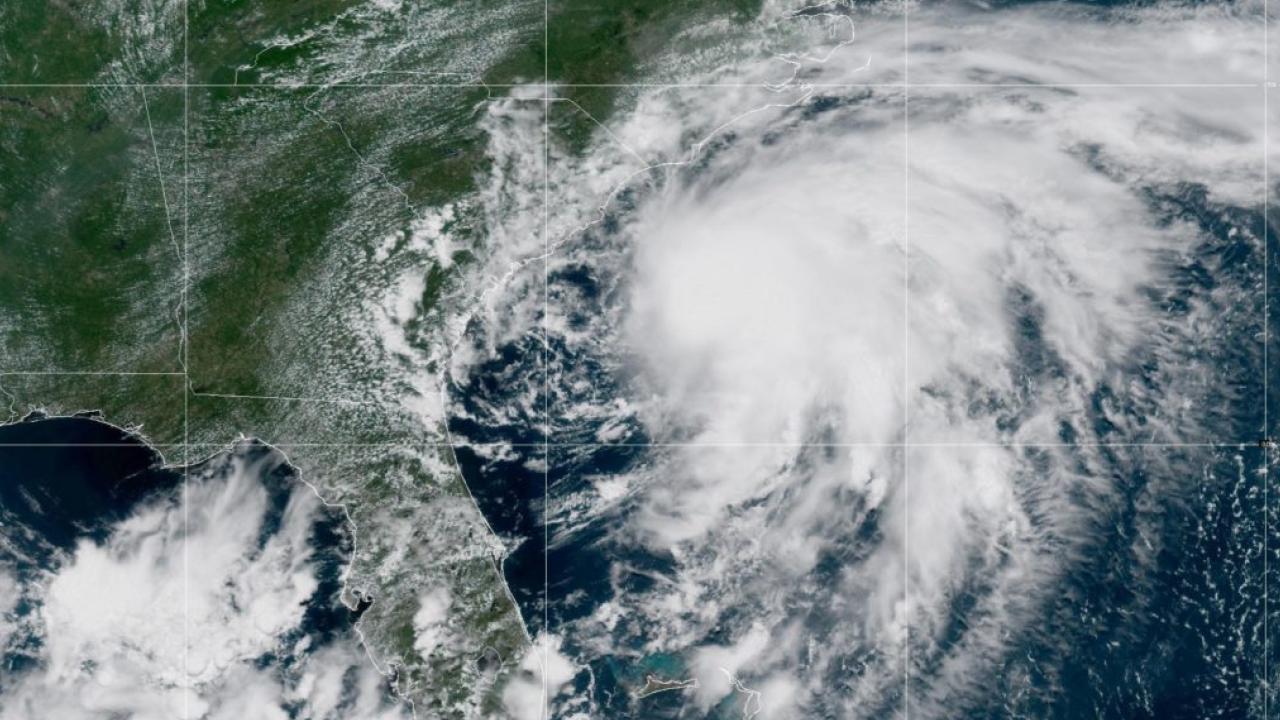
Landfall Is Coming Fast
As of Wednesday morning, Erick was about 70 miles southwest of Puerto Ángel, tracking northwest. Landfall is projected early Thursday between Puerto Ángel and Punta Maldonado.
Here’s what’s expected:
- Sustained winds of 130–145 mph
- Rainfall totals of 10–20 inches (especially inland in Oaxaca and Guerrero)
- Storm surge with waves possibly reaching 20 feet along some coastal stretches
For comparison, that’s nearly the height of a two-story house crashing ashore.
Who’s in Danger?
The storm threatens over a dozen densely populated areas, including tourist hotspots like Puerto Escondido and Acapulco. Communities in Oaxaca, Guerrero, and parts of Chiapas are under full alert. These areas are prone to:
- Landslides in steep terrain
- Flooding along riverbanks and low-lying zones
- Long-term blackouts due to infrastructure damage

Mexico’s Emergency Response
The government has mobilized thousands of emergency workers. Here’s how they’re preparing:
- 580 shelters activated across two states
- 18,000+ responders staged for immediate deployment
- Schools closed, flights delayed, and evacuations underway
- Military assistance coordinating with civil protection units
President Andrés Manuel López Obrador and state leaders have issued urgent calls for residents and tourists to leave vulnerable areas. “We’ve seen what happens when warnings go unheeded. We’re not taking that chance this time,” said Rosa Icela Rodríguez, Mexico’s Secretary of Security and Civil Protection.
What You Should Do Right Now
If you’re in the forecast zone—or know someone who is—here’s a checklist:
- Leave if advised. Don’t gamble. Evacuate early.
- Emergency kit: Pack water, canned food, flashlights, first aid, and copies of key documents.
- Charge up: Phones, power banks, and radios.
- Stay informed: Follow alerts from CONAGUA and the National Hurricane Center.
- Avoid the coast: Waves and surge will be deadly.
The Bigger Picture: Climate Clues
What’s making these storms so fierce, so fast? Scientists point to warmer ocean temps. Erick is the Eastern Pacific’s first major hurricane of 2025, and it’s forming a full month earlier than historical norms. That’s raising eyebrows.
“Storms like Erick aren’t just random. They’re part of a trend,” says Dr. Adriana Ornelas, a climatologist at UNAM. “Rapid intensification is becoming more frequent due to warming seas.”
In fact, 2024 saw a 70% increase in storms that intensified by at least 35 mph in 24 hours. Erick fits that trend—almost too well.
Expert Insight
From my own experience, the most dangerous thing people do during hurricanes is wait too long. I’ve walked through neighborhoods after landfall—windows shattered, roads washed out, and families shellshocked by how fast everything unraveled. Erick’s message is clear: nature’s timeline isn’t ours. Act now, or risk being caught off guard.
FAQs
What is a Category 4 hurricane?
It’s a storm with sustained winds of 130–156 mph. These can cause major structural damage, down trees and power lines, and make areas unlivable for weeks.
Where will Erick likely hit?
The stretch between Puerto Ángel and Punta Maldonado is most at risk, with landfall likely early Thursday.
Is this part of a bigger climate pattern?
Yes. Warmer oceans are linked to storms like Erick forming faster and earlier than in decades past.