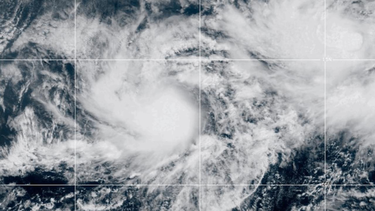
Tropical Storm Chantal roared ashore early Sunday, bringing strong winds, heavy rainfall, and dangerous surf conditions to South Carolina’s coastline. What started as a mild disturbance on Saturday quickly morphed into a menacing tropical system, catching many beachgoers and residents by surprise.

Tropical Storm Turns Dangerous Just Miles From South Carolina Coast
| Takeaway | Stat |
|---|---|
| Wind Gusts Reached | Up to 60 mph |
| Expected Rainfall | 2–4″, isolated 6″ |
| Surf Height | 5–7 feet |
A Sudden Turn Toward Trouble
Chantal took shape Saturday morning just 95 miles southeast of Charleston. Within hours, it strengthened into a tropical storm, prompting urgent warnings for areas from South Santee River, SC, up to Surf City, NC. By early Sunday, it had made landfall just north of Charleston, with sustained winds nearing 60 mph.
The National Hurricane Center issued advisories for Horry, Georgetown, and Charleston counties as Chantal pushed inland. It is expected to lose strength rapidly over land, but not before dumping inches of rain and whipping up dangerous winds.
Surf, Wind, and Flood Threats Loom Large
Heavy rain bands swept into coastal areas overnight, with 2–4 inches of rainfall common and some isolated spots possibly reaching 6 inches. Flash flood warnings are active in low-lying and poorly drained areas.
Winds reached tropical storm strength in many coastal zones, with gusts topping 40 mph and some inland areas feeling the punch. Combined with saturated soil, these winds could bring down tree limbs and power lines.
The coast is also dealing with a dangerous surf scenario. Swells of 5–7 feet have triggered rip current warnings. Lifeguards and emergency services are urging everyone to stay out of the water until the storm fully clears. “We’ve had four rescues already this morning,” said a Myrtle Beach firefighter. “It’s not worth the risk just to get a wave in.”
Tornado Watches in Effect
As Chantal spirals inland, the threat of isolated tornadoes increases. These spin-up storms often occur on the eastern and southeastern edges of tropical systems. The eastern Carolinas remain under a tornado watch through Sunday evening.

What’s Next: Timeline & Forecast
By midday Sunday, Chantal is expected to weaken to a depression as it travels inland toward North Carolina. Rainfall will taper off into Monday, with drier, calmer conditions expected by midweek.
| Timeframe | Forecast |
|---|---|
| Sunday AM | Landfall, peak wind and rain |
| Sunday PM | Storm weakening, risk of isolated tornadoes |
| Monday | Rain exits, improving weather |
How to Stay Safe
If you’re in the affected area, here are a few steps you can take:
- Avoid the beach. Dangerous rip currents and high surf are ongoing.
- Heed local alerts. Flash flooding and tornadoes can happen fast.
- Secure loose items. Outdoor furniture and tools can become projectiles.
- Drive with caution. Flooded roads are deceptively dangerous.
As someone who’s covered tropical systems for years, I’ve seen how quickly things change. A sunny morning can turn stormy in minutes. If you’re anywhere near the coast, stay alert and stay safe.
FAQs
How long will Chantal affect the Carolinas?
Chantal’s effects will be felt through Sunday evening, with most rain and wind tapering by Monday morning.
Should I be worried inland?
Yes, especially in eastern South and North Carolina where flash floods and gusty winds are possible.
Is this storm part of a larger trend?
Forecasters say this early tropical activity could signal a busy Atlantic hurricane season.